171 POPONESSETT ROAD, COTUIT
Owner Information
DAVITT, EMMET & JULIA
122 SOUTH ROLLING ROAD
CATONSVILLE, MD 21228


Property Details
171 POPONESSETT ROAD, COTUIT is classified as a Single Family Residential (Colonial).
The primary structure on this property was built in 1967. There are 3,855ft2 of built area within this property. There is 2,340ft2 of residential/living space within this property. This property is listed as having 8 rooms.
171 POPONESSETT ROAD, COTUIT is valued at $488,700. The land is valued at $168,300 and the structures are valued at $277,600. There is an additional valuation of $42,800 on this property.
This property is in Zone RF. Confirm with local Zoning Board authorities to ensure there are no overlays or other easements on this property.
The most recent deed for 171 POPONESSETT ROAD, COTUIT is recorded at the local registrar in Book 27163, Page 0349. 171 POPONESSETT ROAD, COTUIT was last sold on Wednesday, February 27, 2013 for $411,250.
Assessment data from fiscal year 2022.
Flood Data
According to the FEMA National Flood Hazard Layer, this property does not appear to be in a flood zone. It may also be in an area not yet reviewed. Nonetheless, confirm this information prior to taking any action.
To view the flood hazards around this property, create a FEMA "Firmette" Map of the area around 171 POPONESSETT ROAD, COTUIT.
Broadband Internet Providers
| Provider | Type | Bandwidth (mbps) | |
|---|---|---|---|
| Viasat Inc | Satellite | 35 | 3 |
| Verizon New England Inc. | DSL | 10 | 1 |
| Comcast | Cable | 1000 | 35 |
| T-Mobile | Fixed Wireless | 25 | 3 |
| GCI Communication Corp. | Satellite | 0 | 0 |
| HughesNet | Satellite | 25 | 3 |
| VSAT Systems, LLC. | Satellite | 2 | 1 |
Broadband service provider data from December 2020.
Adjacent Properties
- 181 POPONESSETT ROAD, COTUIT
Single Family Residential owned by TULIS, GERALD & GILMORE, DANL TRS - 11 JACKSON DRIVE, COTUIT
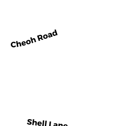
Single Family Residential owned by WARD, RODNEY H & SUSAN S - 88 CHEOH ROAD, COTUIT
Single Family Residential owned by NAGEL, BERNARD MICHAEL & LISA ABRAHAMSON - 76 CHEOH ROAD, COTUIT
Vacant, Conservation Organizations (Charitable Org.) owned by ORENDA WILDLIFE LAND TRUST INC